Tuesday, May 28, 2013

Negro Bill Canyon Trail


Moab, UT 

 Last Friday (5-24) was family hike day and Negro Bill Canyon Trail to Morning Glory Bridge was the hike of choice. The hike is  4.2 miles round trip. It is a constructed trail along a stream.
 

The area is part of the Colorado River watershed and the stream flows directly into the main channel of the Colorado River in Moab Canyon.


The trailhead is on Utah Scenic Byway 128, three miles east from the junction of U.S. 191.


For the first 1 mile or so, the trail follows the stream on the left. We all enjoyed the plant life.


Wild roses and scrub oaks lined the trail.


 This plant caught my eye...I'm not sure what it is.


It was shady and cool.


 We crossed over the stream eight or nine times.

 At one point we climbed the canyon wall and walked along the ridge.
 Wrecks was showing us how easy it is!
 We had nice views of the canyon walls.            
                 
 Morning Glory Bridge is at the end of trail. Unfortunately, I did not have a wide angle lens with me. I was too close to get a picture that shows how big the bridge is.
    
Morning Glory Bridge has a span of 243 feet. It is the sixth longest natural bridge in the U.S.

This is where the trail ends... a huge canyon wall. The water trickling from the wall is where the stream begins. It is so cool and shady here. We had a picnic lunch before starting back.


 I was just a little curious about how this trail got it's name.


The canyon was named after William Granstaff, a prospector and rancher who grazed his cattle here in the late 1800s.


He was the first non-Caucasian pioneer to do so.


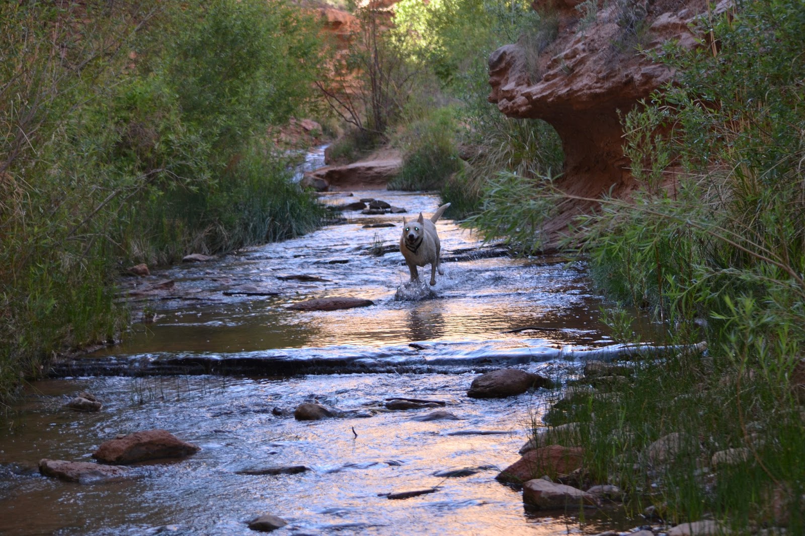
I'm not sure who had more fun on the hike...Dover and Wrecks or Joe and I.


We did meet several other hikers going and coming with pets. Some hikers even had children!


A short video Joe took at Morning Glory Bridge :


At one of the cross overs, we spotted tadpoles.

Dover and Wrecks know how to keep cool...


I also included a short clip that shows how pretty the stream is:


We had a fun hike. What a wonderful way to spend the morning!
 

Y'all come back!


Sunday, May 26, 2013

Delicate Arch Trail

Moab, UT

Last Thursday (5-23) Joe and I were out the door bright and early...destination... Delicate Arch Trail in Arches NP. The trail is about 11 miles from the entrance to Arches.
Delicate Arch Trail is 3 miles round trip. There isn't any shade so go early. Also, the parking lot is not very big. This is a popular hike so spaces are limited. Unlike Devils Garden, there is no overflow area for parking.
 
 
We first visited Wolfe Ranch. John Wesley Wolfe settled in the location in 1888 with his oldest son Fred. He chose this tract of more than 100 acres along Salt Wash for its water and grasslands. The Wolfe's built a one room cabin, a small corral. and a small dam across Salt Wash. For more than a decade, he and his son lived there alone. In 1906, Wolfe's daughter, Flora, her husband and children moved to the ranch. Flora convinced her father to build a new cabin...one with a wood floor! 


After a look there, we crossed a suspension bridge over Salt Wash.


Continuing on, we took a short spur trail that leads to a wall of petroglyphs. These petroglyphs are identified as a Ute hunting panel and are easily dated after 1500's, the date Spaniards introduced the horse to the New World.


future photographer!


    From there we headed up a winding trail...


...until we reached the base of a slickrock incline. The tiny spots at the top of the slickrock are people!


The trail completely disappears and cairns mark the way.


           As the pictures show, this is a slow, steady climb...


...until we reached an area of sandy washes and rock outcroppings. We were careful to stay on the trail, but there didn't seem to be a clear path here.


The last part of the trail is a narrow ledge. There is a nice view of Frame Arch on your left.
Frame Arch


Up until this time, Delicate Arch has not been visible.


But just as we walked around the ledge, Delicate Arch came into view...a WOW moment for sure!


Delicate Arch is a 65 -foot tall freestanding natural arch. It is the most widely recognized landmark in Arches NP and is depicted on Utah license plates. The Olympic torch relay for the 2002 Winter Olympics passed through the arch. 


A beautiful view of the La Sal Mountains looking through the arch.

A look in the other direction is a view of the main road that winds through Arches.  After lots of pictures and visits with other hikers, it was time to go.

The hike back to the parking lot was not so bad...we entertained ourselves by finding and naming a few rock formations...


 We named this rock "porta potty"!


And this one "Pig".
 
We sure enjoyed this hike! 
 
 
Hope you had a great Memorial Day Weekend!

Thanks for stopping by.