July 25, 2018
Port A, WA
Doesn't everybody love waterfalls? ONP has lots of opportunities to go "waterfalling"...a term I learned to use if someone goes out to explore waterfalls...so while here we visited three.
Marymere Falls
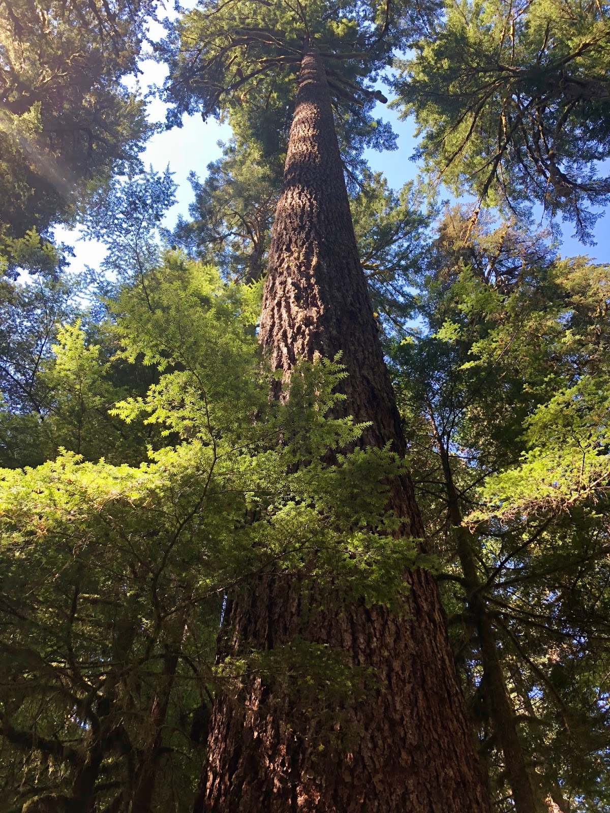
Parking for Marymere Falls is located near Lake Crescent at the Storm King Ranger Station. For safety, the trail traverses through a tunnel under WA Hwy 101. Surrounded by old growth forest, ferns and carpets of moss, this shaded 1.7 mile in/out trek crosses a couple of creeks.
 |
| First, Barnes Creek... |
 |
| then, Falls Creek |
From here the trail ascends a couple hundred feet to the first of two overlooks of the falls. The first overlook gives a view directly in front of the base of the falls...though not quite close enough to feel the mist.

Around a corner and a few more steps on the edge of the ravine (thank goodness for a rail), the second viewpoint looks down...sort of...on the 90' waterfall.


We thought this short hike was a lot of fun. Before heading back to town, we enjoyed a lunch snack among the daisies with a perfect view of Lake Crescent.


Madison Falls
Another day, we headed just a few miles from home on WA Hwy 101 to Elwha Valley Road to check out Madison Falls and explore Elwha River. Unfortunately, the parking lot for Madison Falls was as far as we could go in our vehicle on the Valley Road due to a washed out bridge. Surprisingly, the parking lot was almost empty for the very short stroll to Madison Falls.

I say short as it is less than a mile...an in/out trail on a paved walk (ADA accessible). Not much of a "hike", but the waterfall is quite pretty with access for an up close and personal experience.

Moss, a wall of ferns, oak and maple trees in their summer glory all add to wonderful shades of green that definitely give this fall a pop.


Afterwards, we walked across the street from the trailhead parking lot to the Elwha River where we marveled at the color of the water and did a little rockhounding among the river rocks.


The Sol Duc Valley is located about 25 miles west of us on WA Hwy 101. Unfortunately, road construction on 101 caused several delays adding close to 45 minutes to our travel time each way. The drive to Sol Duc Falls is along the Sol Duc River which is a "key highway" for coho salmon. A stop along the way is Salmon Cascades.


Fall and summer coho salmon can be seen here...what a treat that would be. There is a small viewing platform, but for the best view there are paths that lead down to the river.
Thats exactly where I went !

Sol Duc Valley, the river and hot mineral springs were well-known by Quileute Indians and other inhabitants. In fact, it was the Quillayute people that gave the river its name. Sol Duc translates to "sparkling waters". It was in the 1880s that a timber baron decided to make the area famous by buying some property and building a retreat for friends and visitors...the rest is history (which included a 5-star resort completed in 1912 that burned down four years later).

The National Park service purchased the Sol Duc resort in 1966 and incorporated it into the ONP.
The resort was completely rebuilt in the 1980s and its hot mineral baths still attracts thousands.
 Three main springs are piped into the swimming pool and three soaking pools. Only the large swimming pool is chlorinated. It was crowded today so I didn't get a good picture.
With time being an issue, we chose to drive to the end of Sol Duc Road and take the shorter of the two hikes to the falls.
Round trip it is 1.6 miles of gently sloping trail through yet another gorgeous forest of Sitka Spruce, Douglas fir, and every shade of green possible.

Also along the trail is the only remaining CCC-constructed shelter in the Olympic backcountry.

Canyon Creek Shelter was built in 1939 overlooking the falls. It is a T-shaped. one-story log building with a wood-shaked, cross gabled roof set on a concrete foundation.
The shelter was added to the National Register of Historic Places in April 2007 for its architectural significance and association with the CCC.


There are several viewpoints to enjoy Sol Duc Falls. The first is from a bridge that crosses Sol Duc River. The falls cascade 48' into a very narrow rocky gorge.


But my favorite was getting my feet wet in the swift flowing waters of the river. And yes, it was chilly !


Waterfalls are naturally beautiful and it's hard to deny their soothing presence. We usually hear them long before we see them...my cue it's time to hurry along. Each of the waterfalls we visited were unique in their own way...Marymere with its height and grandeur, Madison with its graceful flow calling you to share in its space with nature, and Sol Duc with a commanding presence and thundering splash as the river makes its way to the Pacific Ocean.
Until next time,


HAPPY TRAILS !


