Showing posts with label Red Rock Scenic Byway. Show all posts

Sunday, April 21, 2024

Yavapai Point and Montezuma Well National Monument

Distant Drums RV Resort

Camp Verde, AZ

April 21, 2024 

Our last two days at LDSP were spent staying put and just enjoying doing nothing...well unless you call walking, sitting, grilling and taking in the beauty something to do.  Late afternoon walks to capture the sunsetting is magical at LDSP.  The well known Superstition Mountains that grace the park all day turn from a dull brown/gray color to a beautiful orange/red color right before you eyes.  

Morning walks with Sally...


Late afternoon magic... 


Thursday was travel day.  

Sally settled in under my foot stool...


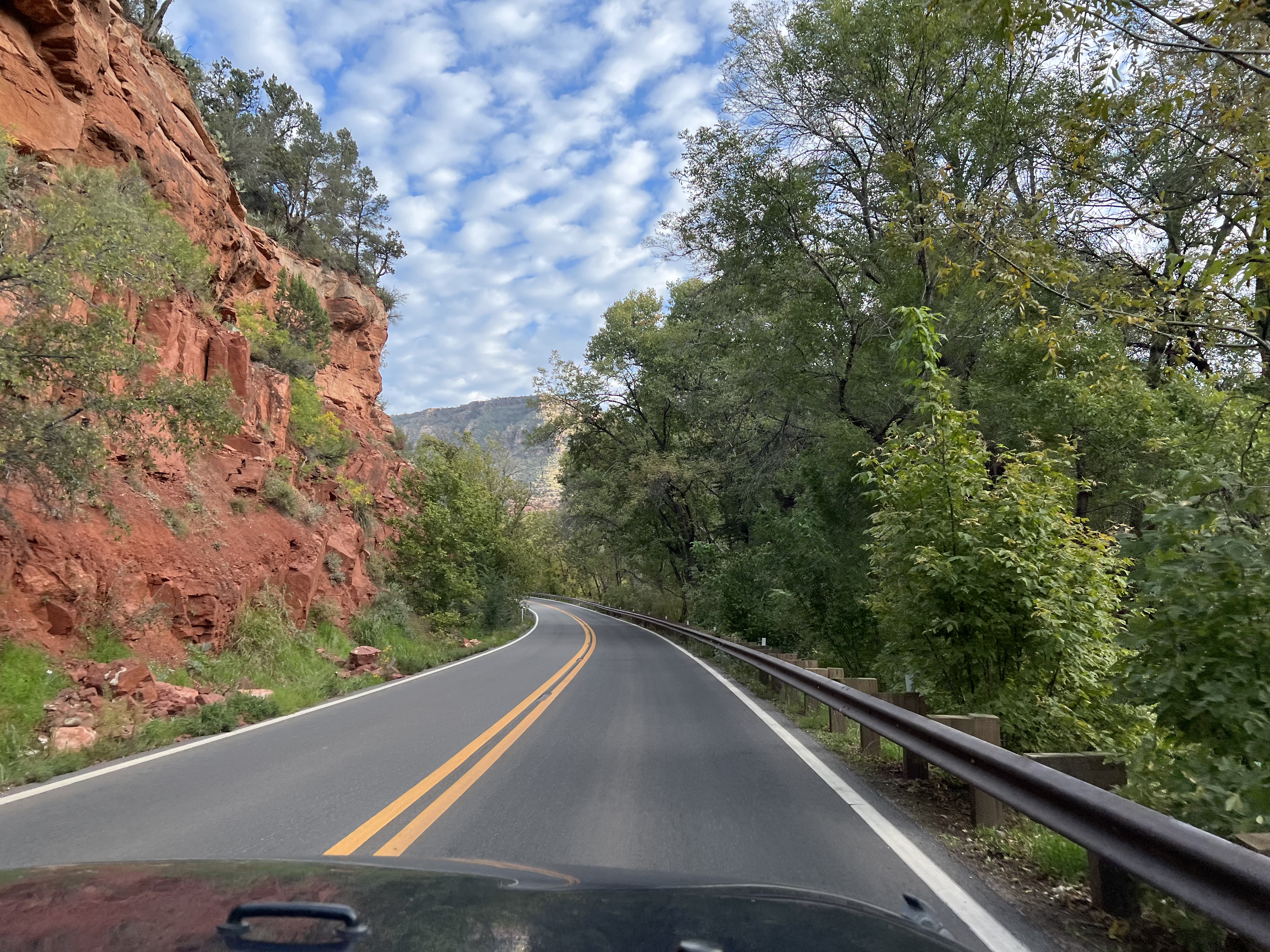
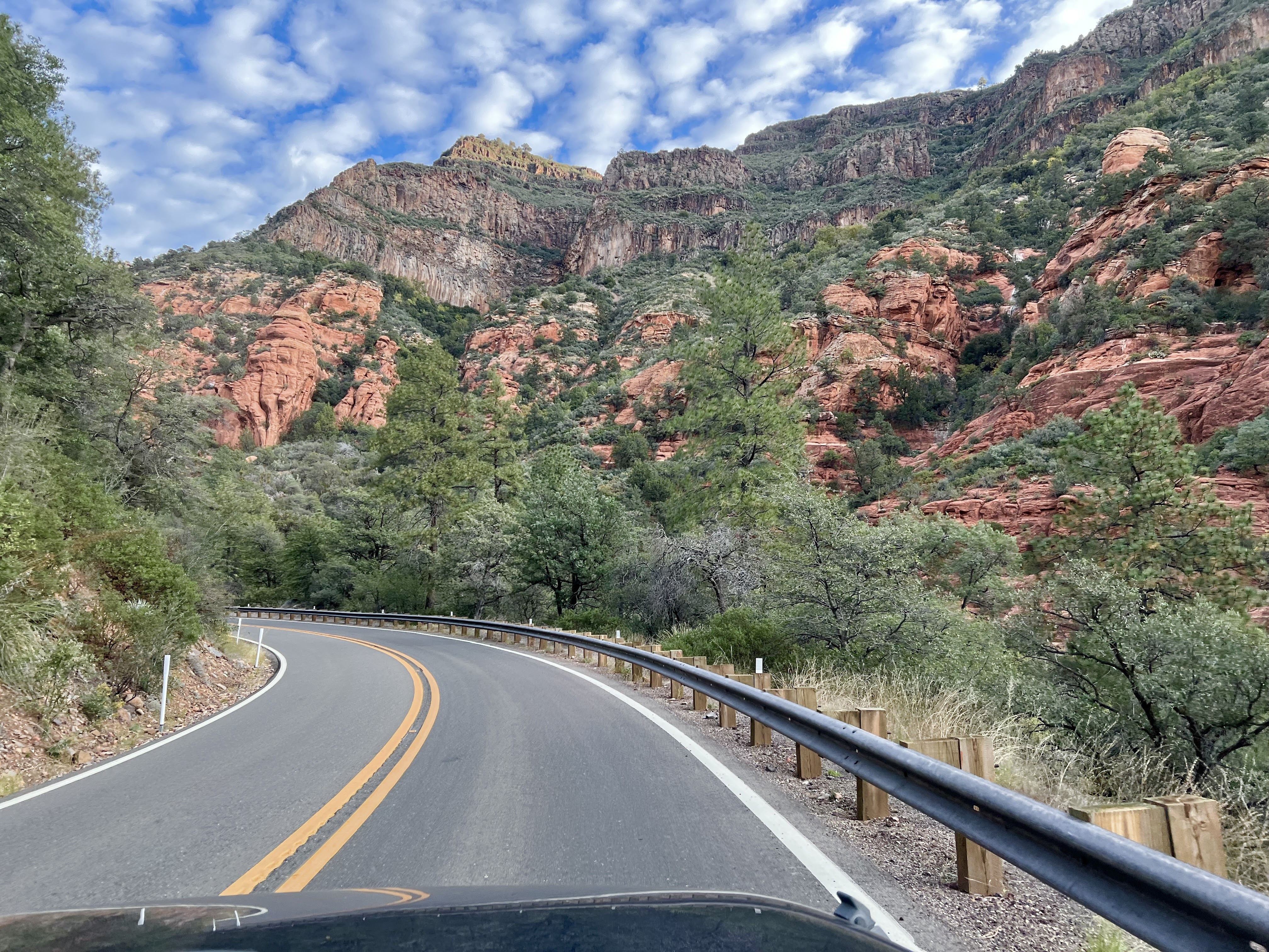
I enjoyed watching the beautiful scenery...


and Joe did his thing managing the ups and downs, twists and turns of the highway.


We are now all settled in at Distant Drums with a nice pull-in site.  We face west...I am happy ! 


And Sally is happy...she has grass.


The down side...the afternoon breeze has blown the Cottonwood tree's fluffy white seeds everywhere.  The tree is huge and about three sites down from us.


It looks like it is snowing.  The seeds stick to our clothes and in our...well, my hair and Sally's nose and the AC intake.    
   

It's very much worth the mess.


So, what have we done the past couple of days.  Friday was errands to restock veggies and dairy products, but not without a stop for maps at the Ranger Station/Visitor Center and a fun stop at Son-Silver first...both located on State Route 179.   Even though we have visited Camp Verde several times during the past years, we have not stopped by the VC since April 2014...our first visit to the area.  We took a few minutes to study the exhibits.  


This was my favorite display.  

It began with the footprints of a tiny field mouse and ended with these of the bear. When you flip the card there is lots of info about the animal.  And yes, that is the bear's poop!  

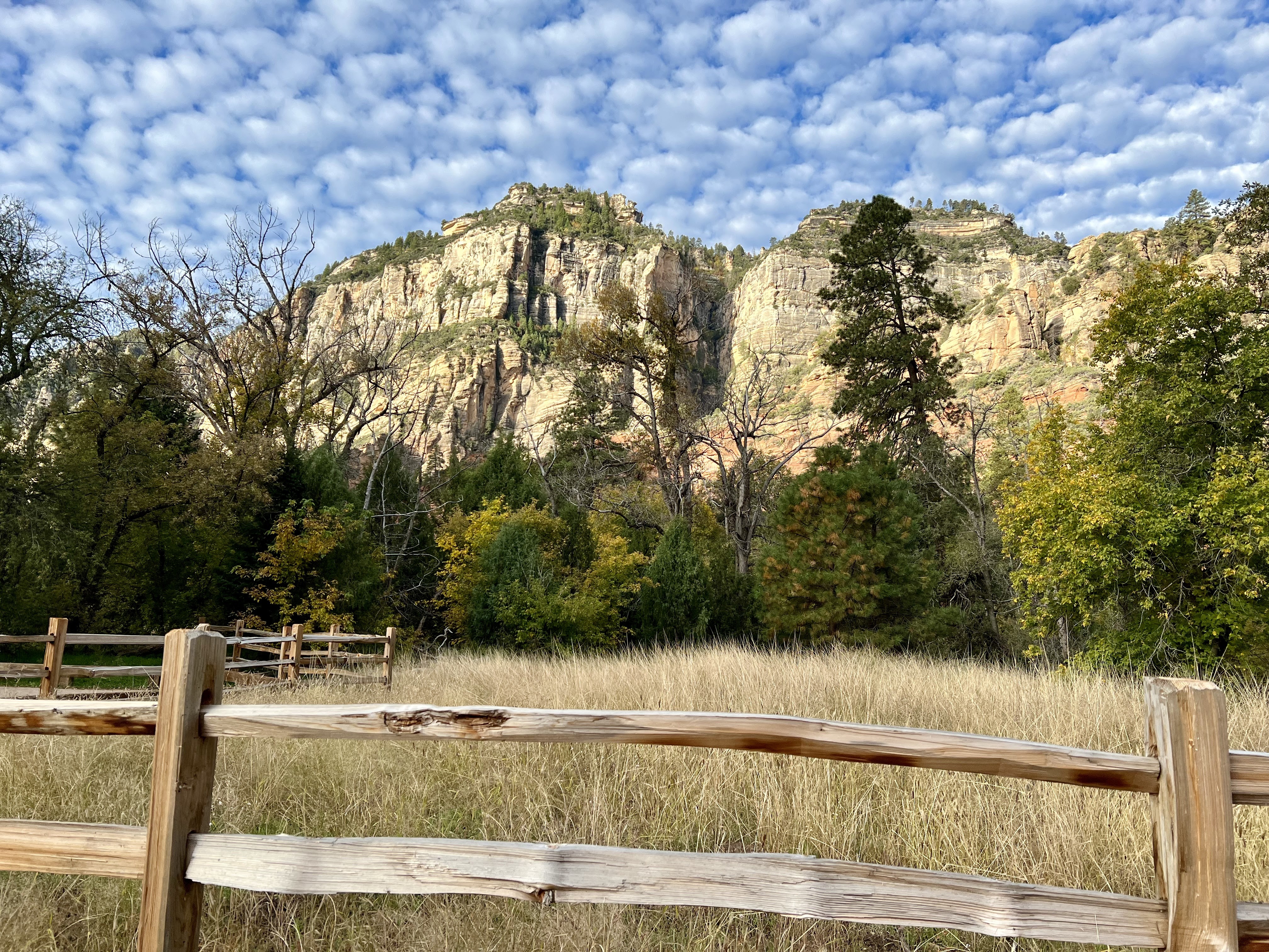
A favorite scenic drive is Red Rock Scenic Byway...also known as State Route 179. This byway is less than 8 miles from the interstate and ends within the Sedona city limits. There are many hiking/biking trails and parking areas along the road.  There are also beautiful up close and personal red rocks.  

Bell Rock and The Courthouse

Son-Silver is just fun and I can not imagine coming here and not going there.  


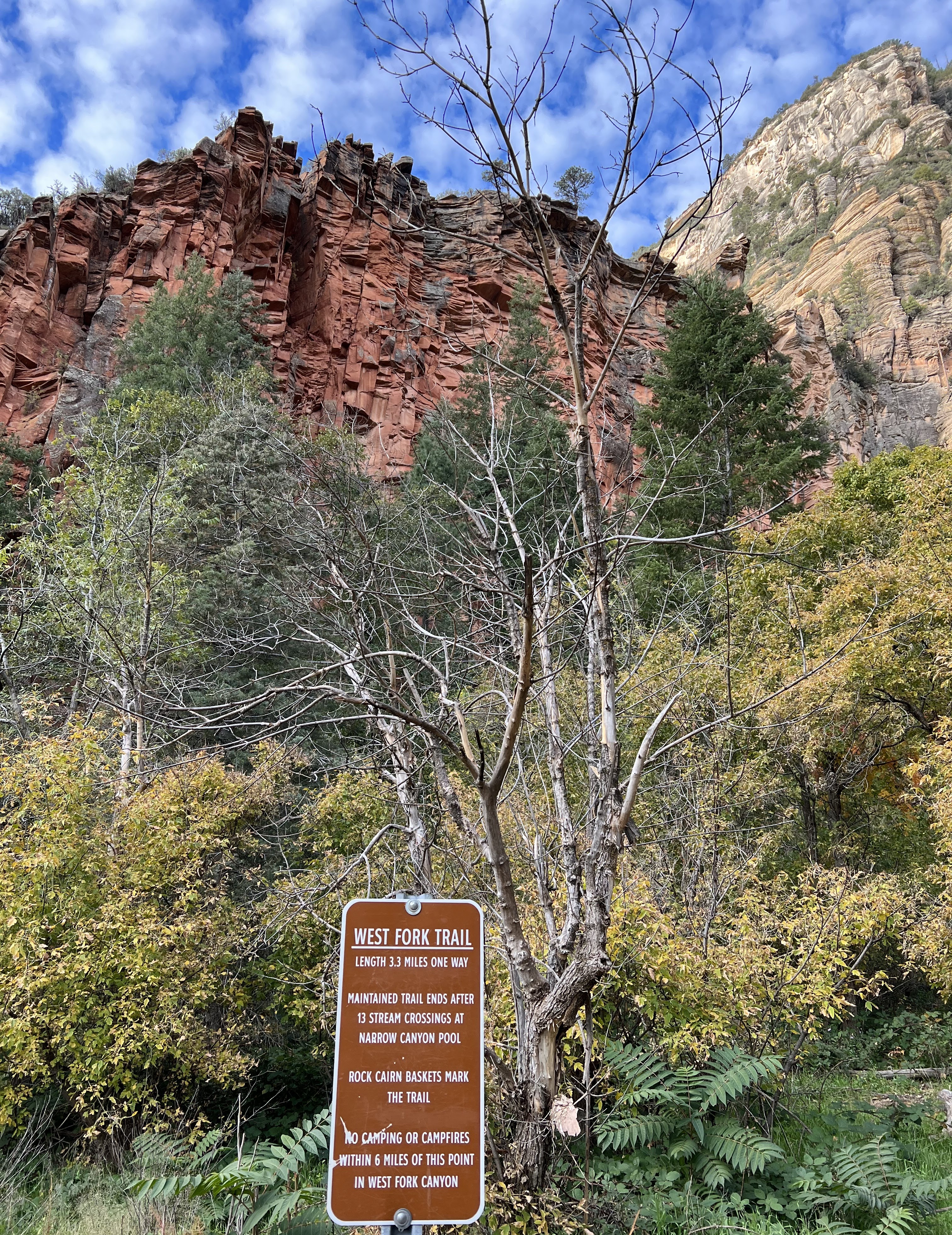
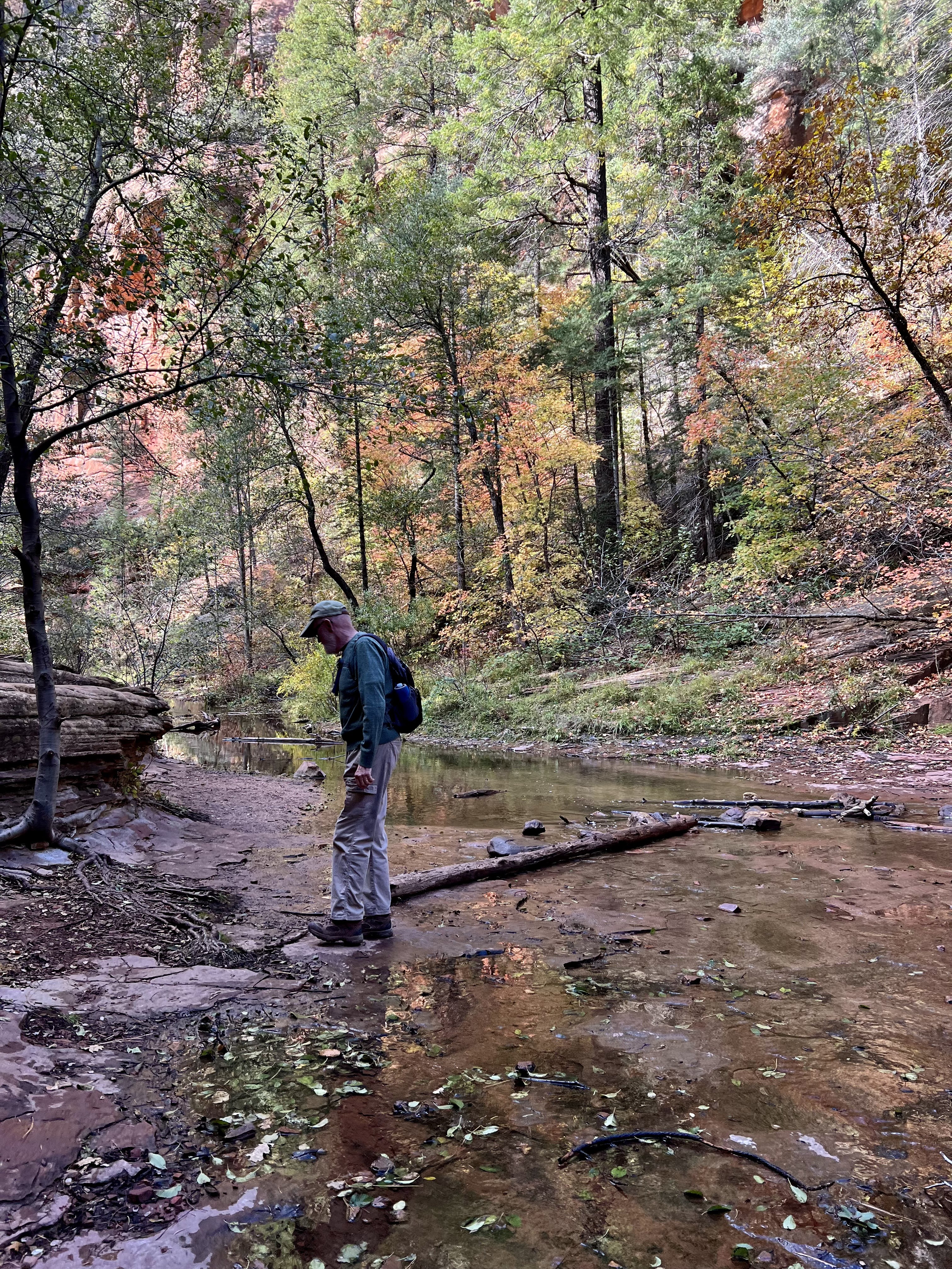
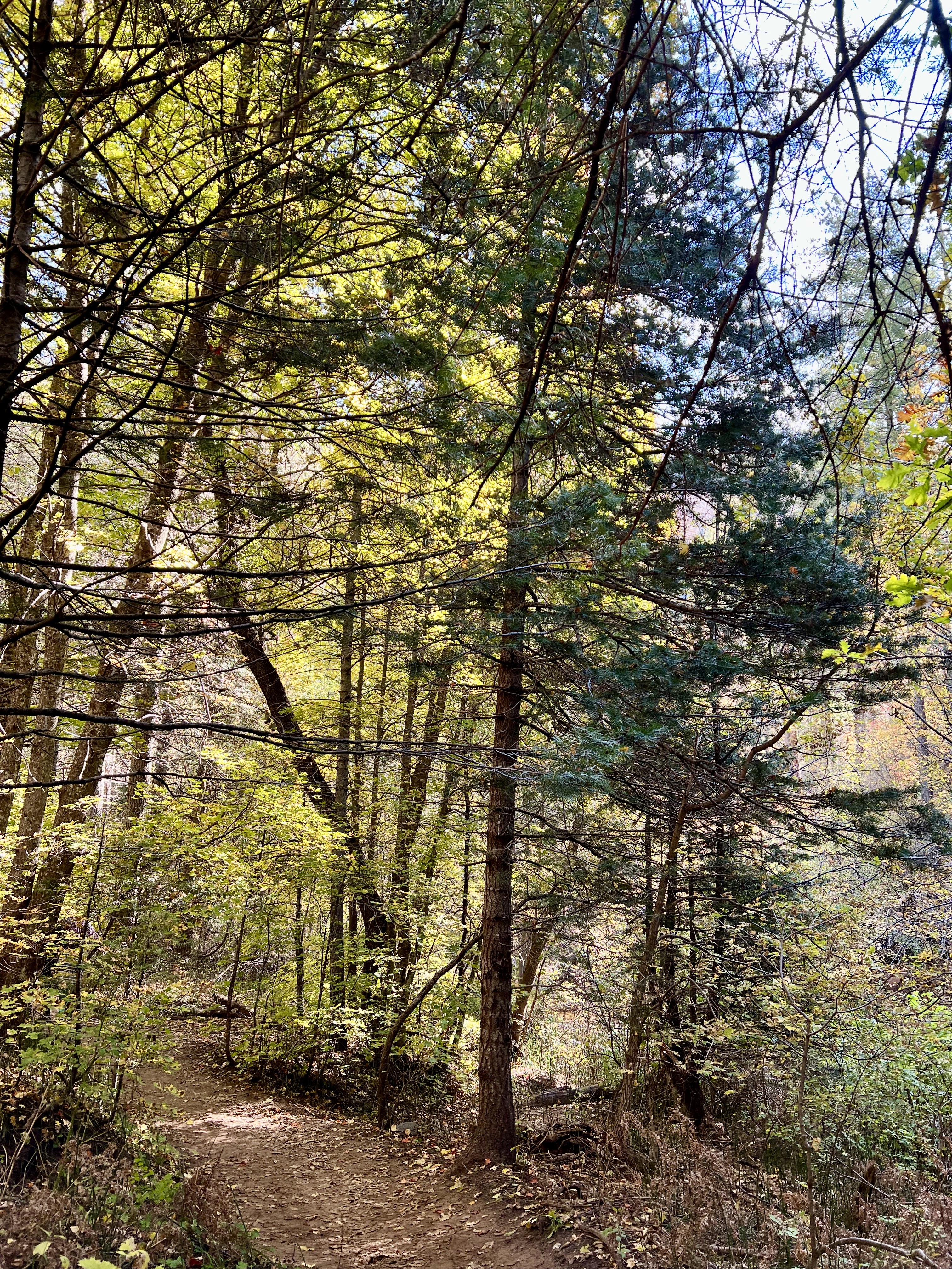
Saturday was hiking day.  Our choice for parking was Yavapai Point.  We combined the Yavapai Vista, Basalt, and Slim Shady Trails for a nice 2.5 miles.  


Lots of big views to take in along the trail...


And lots of little things too.

The creamy color of cliff rose...

Blue/gray Juniper berries...

Red and green Manzanita bushes

And dainty little daisies that put a smile on my face.


On the way home we made a stop at Montezuma Well National Monument.  It's a new stop for us and just like Montezuma Castle, which we visited for the first time in the fall of 2022, we were glad we did.  


The first POI is the ruins of a pithouse that was discovered here in 1958.  It took three weeks to excavate this site. 


The two larger holes in the middle of the dirt floor held the main roof support timbers and the smaller holes around the edge reveal the outline of the house where the wall posts were placed in the ground.  The entry is the  small extended section on the right. 

The pithouse was built around 1050 AD by farming families who used the resources on hand for either a multi family home or a community structure. 


Montezuma Well is really not a well and Montezuma was never here so why it is called Montezuma Well is a mystery to me.  None the less, it is an amazing piece of history from years gone by.  It's a nice paved walk up to the well.  As with he castle we did not know what to expect and were quite surprised.  The "well" is a limestone sinkhole that is continuously fed with water from an underground spring.  

The "well" measures 386 feet in diameter from rim to rim and measures 55 feet deep.   More than a million gallons of water a day flow into the well.  To date, the source of the water has not been discovered.  The "well" with its unique geology and primordial origins provides refuge to species of animals and plants found nowhere else in the world.   

Near the top of the ridge is a cliff dwelling...


A downhill spur trail close by has two POIs.   


The water in the "well" exits thru an underground side cave.   First, you can see the spring that flows from the well.  The water from the well that exits here has been used for many, many years by the people who lived here for irrigation and is still used for that today.  


A few more steps down the second POI is another dwelling site.  

The graffiti you see in the photo was by a photographer who left his advertisement for business there in 1818.  He was a photographer...go figure!  

The graffiti in the photo was left in 1896 by Duke Heflin...


Further along the main trail is one more spur trail that goes to the creek, the outlet, and the canal used for irrigation by the early inhabitants who lived here.  

The narrow walk that hugged the cliff made it difficult to get a photo of the creek, but the sound of the running water was music to my ears.


Wet Beaver Creek is a tributary of the Verde River.

The outlet flows into Wet Beaver Creek.

The man-made canal for irrigating.

The up shot by the creek...


The down shot by the small canal...


Today was a stay at home with Sally day, reading, napping, and blogging kind of a day.  


Hope you have a great week.  Until next time, 

Yavapai Vista Trail

One of the spur trails at Montezuma Well

HAPPY TRAILS!

Tuesday, October 25, 2022

The Call of the Canyon...West Fork Trail

Distant Drums RV Resort

Camp Verde, AZ

October 21, 2022 

Call of the Canyon was a silent western movie filmed in 1923 based on a Zane Grey novel of the same name.  The setting for the film was in Oak Creek Canyon and it is credited with being the first movie filmed in Sedona.  We have hiked the canyon twice...first in April 2014 and second in May of 2015. Spring is definitely a great time to visit, but I always wanted to return in the fall.  Our two week get away was quickly planned when I mentioned to Joe that I would love to return to Oak Creek Canyon for a fall hike. This was the year !

Sunrise as we drove north on I 17 towards Sedona.


We headed out just before 7:00 am.  West Fork Trail is about 10 miles north of Sedona on Hwy 89A so it was a bit of a drive from Camp Verde.  No worries...well, at least not for me as my responsibility was to take photos along the way.  First few miles were on AZ State Route 179 or Red Rock Scenic Byway.

Bell Rock and Courthouse Rock on Hwy 179 going into Sedona.


A right turn in the center of Sedona onto Highway 89A goes all the way to Flagstaff.  Oak Creek Canyon is about 10 miles north of Sedona.  Rand McNally named Highway 89's panoramic path through Oak Creek one of the most beautiful drives in America...designating it Arizona's first scenic route.   


It is hard to take in all the sights as you wind and twist around hairpin curves. 


Parking for the hike is $11.  It is best to go early to get a parking space and beat the crowds. I am already excited when we get there...and have to remind myself to breath.   


From the parking lot, there is a paved trail that meanders thru an apple orchard, over Oak Creek, and among the crumbling remains of old buildings built sometime in the 1870s.  

Carl Mayhew, a photographer on the set of Call of the Canyon (1923) was so captivated by the cabin and the surrounding beauty that he purchased the property in 1923.  


The cabin was renovated and expanded and in 1926, he opened a bed and breakfast.  Over the next decades, notable guests included President Herbert Hoover, Walt Disney, Clark Gable and Jimmy Stewart.  The lodge closed in 1968 and the Mayhew family sold the property to be added to the Coconino National Forest.


West Fork Trail begins shortly after the crumbled remains.  The trail is just over 6 miles round trip.  We did the 6+ miles back in 2015.  Friday's plan was to walk and enjoy with no goal or pressure to finish.  


No matter what the season, the canyon is noted for its narrow walls, dramatic rock formations, and the changing colors of the cliffs.  


The trail is well maintained and mostly easy to traverse.


The creek crossings (there are 13 of them if you go to the end) are a little more tricky.  Some are harder than others...

hard...

easy...

And sometimes, climbing out of the creek was tricky.


We stopped a lot to look up.


We stopped a lot to look down.


And we stopped a lot to just take in what was right in front of us.


Oak Creek, time and weather created this narrow, enchanting gorge. 


It was a wonderful morning.  Chilly from the get go and warmed up nicely.  We beat the crowds.  I took a kazillion photos.  We both managed to finish the hike with dry feet. And the fall colors were better than I had ever hoped for.  


Until next time,


HAPPY TRAILS !

P.S. For some reason the photos loose quality when downloading them to the blog.  If you click on the photo, the clarity is way better.